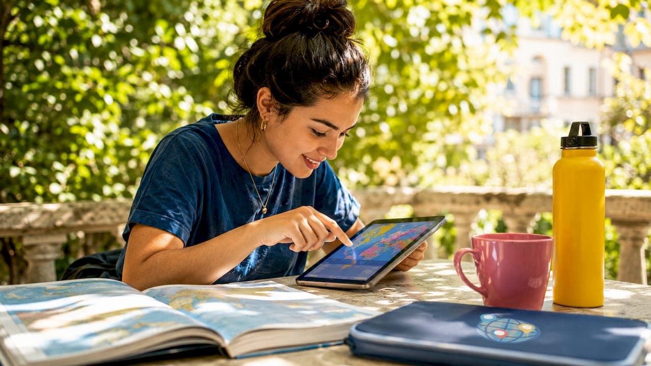
Map-based quiz games are interactive digital tools where players identify locations, countries, or capitals directly on a map, blending education and entertainment in a format that works for both classrooms and casual play. Platforms like Seterra, GeoGuessr, and Sporcle have proven that geography learning sticks better when players click, guess, and compete in real time. The best examples of map-based quiz games share a common trait: they make the map itself the interface, not just a backdrop. Whether you are a teacher building a lesson plan or a gamer chasing a high score, knowing which games deliver the right mix of challenge and feedback changes how you learn.
What makes map-based quiz games effective and engaging
Effective map quiz games share a specific set of mechanics that separate them from static flashcards or passive reading. The most impactful feature is real-time scoring with instant feedback, where correct answers turn green and wrong ones turn red, giving players immediate reinforcement without waiting for a results screen. That instant loop keeps motivation high and shortens the time between mistake and correction.
Question variety matters just as much as feedback speed. Strong geography quiz games rotate between clicking on map regions, typing country names, and selecting from multiple choice options. This prevents players from memorizing button positions rather than actual geography. Randomized question order combined with progress tracking pushes players to genuinely learn rather than pattern-match.
The best games also layer in metadata. A quiz that asks you to identify Egypt on a map becomes far more educational when it also surfaces the capital, flag, population, and a historical fact. Some challenges require identifying up to 30 countries across multiple map segments, integrating several learning layers into a single session. That depth is what separates a trivia distraction from a genuine study tool.
User interface design is the silent factor most players never consciously notice. Clean map rendering, readable labels, and accessible color contrast determine whether a player stays for ten minutes or ten seconds. Designing around the user type optimizes both engagement and educational outcomes. Students need clarity and study aids; trivia fans want timers and leaderboards.
Pro Tip: Before choosing a map quiz platform, identify whether your primary goal is retention or competition. Study-focused players benefit most from games with metadata overlays and progress tracking, while competitive players get more from timed rounds and score multipliers.
Top examples of map-based quiz games
The following games represent the strongest interactive map quiz examples available today, each with a distinct approach to geography learning and player engagement.
1. Seterra
Seterra is the most established geography quiz platform for structured learning, available in over 40 languages and covering countries, capitals, flags, oceans, and continents. Its quiz library spans beginner to advanced levels, making it equally useful for a middle school classroom and a competitive trivia player. The click-on-map format is clean and fast, with no distractions pulling attention away from the geography itself. Seterra's longevity reflects a simple truth: when the content is accurate and the interface is frictionless, players return.
2. GeoGuessr
GeoGuessr takes a fundamentally different approach by dropping players into a street view environment and asking them to pinpoint their location on a world map. This immersive format trains spatial reasoning and visual geography recognition rather than rote memorization. A player who can identify a country from its road signs, vegetation, and architecture has internalized geography at a deeper level than someone who has only clicked on labeled outlines. GeoGuessr appeals strongly to exploration-minded gamers who want geography to feel like an adventure.
3. Sporcle map quizzes
Sporcle hosts thousands of map quizzes ranging from simple country naming to complex continent identification challenges, making it one of the most accessible platforms for all skill levels. Its community-created quiz model means new content appears constantly, covering niche topics like landlocked countries, island nations, and historical borders. Sporcle works particularly well for educators who want to assign specific quizzes without building them from scratch. The platform's breadth is its biggest asset.
4. Educaplay Map Quiz Maker
Educaplay is built specifically for educators who need to create customizable map quizzes for classroom use. Teachers can upload custom maps, define clickable regions, and set answer parameters without writing a single line of code. This makes it one of the most practical educational map quiz apps for instructors who teach regional geography, historical territories, or subject-specific spatial content. The ability to tailor every element of the quiz to a lesson plan gives Educaplay a clear advantage in formal education settings.
5. Lizard Point Quizzes
Lizard Point offers over 200 interactive map quizzes covering countries, states, cities, and flags, with a focus on clean, distraction-free study. The platform suits students who need repeated practice on specific regions without the gamification noise of leaderboards or timers. Its depth of content makes it one of the better online geography quiz games for systematic study, particularly for standardized test preparation or geography competitions.
6. Worldlecity daily city guesser
Worldlecity transforms city geography into a daily guessing game where players receive a photograph of a mystery city and have six attempts to identify it. Each guess returns proximity and directional feedback, training players to think about global city distribution rather than just memorizing names. For educators, the difficulty-based quiz modes stack four levels of challenge, which creates a structured progression path that a daily random quiz cannot replicate. Students who work through difficulty tiers build geography knowledge systematically, which produces stronger retention than one-off daily challenges.
7. Hostinger's no-code map quiz builder
Developers and educators who want to build their own interactive map quiz examples can use AI-assisted no-code builders to create custom geography games with real-time scoring, leaderboards, and visual feedback. This approach works well for teachers who need quizzes tied to specific curriculum maps, such as a state's county boundaries or a historical empire's territory. Building a custom quiz also allows full control over question format, difficulty, and metadata depth.
8. IRC world maps quiz
The International Rescue Committee's world maps quiz uses silhouettes, neighboring country relationships, and landmark identification to teach geography through context rather than isolation. This format is particularly effective for learners who struggle with blank-map recall because the surrounding visual context provides memory anchors. It also integrates historical and humanitarian facts, making it one of the more purpose-driven examples of map-based quiz games available for free.
Comparing map quiz games: features, usability, and audience fit
Choosing the right platform depends on what you need the game to do. The table below compares the core features of the top map quiz games covered in this article.
| Platform | Quiz format | Feedback type | Best for | Difficulty options |
|---|---|---|---|---|
| Seterra | Click on map region | Instant color feedback | Students, self-study | Multiple levels |
| GeoGuessr | Street view location pinning | Score based on distance | Gamers, explorers | Varies by map |
| Sporcle | Type or click answers | Score at end | Trivia fans, all levels | Wide range |
| Educaplay | Custom click regions | Configurable | Educators, classrooms | Fully customizable |
| Lizard Point | Click on map | Immediate correct/wrong | Students, test prep | Region-specific |
| Worldlecity | Photo-based city guessing | Proximity and direction | Gamers, students | Four difficulty tiers |
Timers, score multipliers, and leaderboards create competitive environments that motivate repeated play. Platforms like Sporcle and GeoGuessr lean into this competitive layer, while Seterra and Lizard Point prioritize clean study mechanics over social competition. Worldlecity sits between both worlds, offering casual daily play alongside structured difficulty-based quizzes that educators can use as a progression tool.
Creative map quiz game ideas for educators and developers
Building or selecting a map quiz game with intention produces far better learning outcomes than picking the most popular option. These concepts apply whether you are designing a new game or adapting an existing platform for classroom use.
- Thematic regional quizzes. Focus a quiz entirely on one continent, historical period, or geopolitical theme. A quiz covering only post-Soviet states, for example, teaches political geography and history simultaneously.
- Fuzzy answer matching. Fuzzy matching algorithms accept common misspellings and alternate country names, reducing player frustration and dropout. Without this feature, rigid input validation punishes players for minor typos rather than genuine ignorance.
- Flashcard integration. Pairing a map quiz with digital flashcards on the same region reinforces visual and verbal memory pathways. Tools like Quizlet can complement a Seterra session on the same topic.
- Live multiplayer rounds. Running a map quiz as a live classroom event, where students compete simultaneously on the same questions, produces the kind of social engagement that solo study cannot replicate.
- Difficulty progression paths. Customizing quiz difficulty by region and question type enhances learning retention and user satisfaction. Start students on continent-level identification before moving to individual countries, then capitals, then flags.
- Historical map overlays. Using maps from different time periods teaches students that borders change, which adds a critical thinking layer to standard geography recall.
Pro Tip: If you are designing a map quiz for a classroom, build in at least three difficulty tiers from the start. Students who master the easiest level need a clear next step, or they disengage. Worldlecity's four-tier difficulty structure is a practical model worth studying.
Key takeaways
The most effective map-based quiz games combine instant feedback, varied question formats, and audience-specific design to produce genuine geography learning rather than passive entertainment.
| Point | Details |
|---|---|
| Feedback drives retention | Instant color-coded responses and proximity scores accelerate learning more than end-of-quiz summaries. |
| Platform choice depends on goal | Educators need customization tools like Educaplay; gamers benefit from immersive formats like GeoGuessr. |
| Difficulty tiers matter | Structured progression from easy to hard, as seen in Worldlecity, builds knowledge more reliably than random daily challenges. |
| Fuzzy matching reduces dropout | Accepting minor typos and alternate names keeps players engaged and focused on geography, not spelling. |
| Metadata deepens learning | Quizzes that surface capitals, flags, and historical facts alongside map identification produce stronger retention. |
Why I keep coming back to map-based quiz games
I have spent years testing geography quiz tools for both personal use and classroom recommendations, and the pattern I keep seeing is this: the games that feel the most like games produce the best learning outcomes. GeoGuessr taught me more about Central Asian road infrastructure than any textbook I read in school. Seterra drilled West African capitals into my memory through sheer repetition and clean design. What neither of them does particularly well is structured progression for students who need a clear path from beginner to advanced.
That gap is where difficulty-tiered platforms earn their place. When I looked at Worldlecity's approach, specifically the four difficulty modes stacked on top of the daily city guesser, I recognized something that most quiz platforms skip entirely: the acknowledgment that learners are not all at the same level on day one. A student who cannot yet identify continents reliably should not be thrown into the same quiz as someone who can name every capital in Southeast Asia. The difficulty structure respects that reality.
My honest recommendation for educators is to use Seterra or Lizard Point for systematic content coverage, GeoGuessr for engagement and exploration, and a difficulty-tiered platform like Worldlecity for structured student progression. No single platform does everything well. The best geography learning programs I have seen combine at least two of these approaches.
— Pran Gran
Try Worldlecity for daily geography challenges
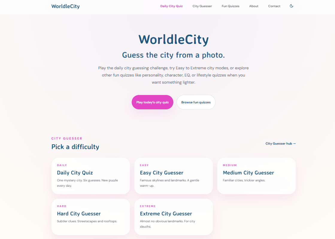
Worldlecity is a free daily city guessing game that gives you a photograph of a mystery city and six attempts to identify it, with proximity and directional feedback after each guess. What makes it particularly useful for students is the difficulty-based quiz mode, which stacks four levels of challenge so learners can build geography knowledge progressively rather than jumping straight into hard content. No account registration is needed, and results can be shared with classmates or friends to add a social layer to the learning. If you want to put your geography skills to the test or give your students a structured challenge, start playing on Worldlecity today.
FAQ
What are map-based quiz games?
Map-based quiz games are interactive digital tools where players identify locations, countries, capitals, or landmarks directly on a map interface. They combine geography education with game mechanics like scoring, timers, and feedback to make learning more engaging.
Which map quiz game is best for classroom use?
Educaplay's Map Quiz Maker is the strongest option for educators because it allows fully customizable quiz creation without coding. Worldlecity's difficulty-tiered quizzes also work well for structured student progression from beginner to advanced levels.
How does GeoGuessr differ from traditional map quizzes?
GeoGuessr uses street view imagery rather than labeled map outlines, asking players to identify their location based on visual environmental cues. This trains spatial reasoning and real-world geography recognition rather than rote map memorization.
Why does fuzzy answer matching matter in map quiz games?
Fuzzy matching accepts minor typos and alternate country names, preventing players from losing points for spelling errors rather than geography mistakes. Without it, rigid input validation causes frustration and player dropout.
Can map quiz games work for all age groups?
Yes. Platforms like Seterra offer multiple difficulty levels and are available in over 40 languages, making them accessible for young students through adult learners. Sporcle's range from simple country naming to complex continent challenges covers every skill level.